
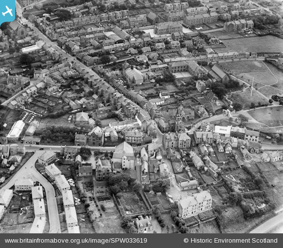
SPW033619 SCOTLAND (1930). Kirkintilloch, general view, showing Old Church, Cowgate and High Street. An oblique aerial photograph taken facing south.
© Copyright OpenStreetMap contributors and licensed by the OpenStreetMap Foundation. 2024. Cartography is licensed as CC BY-SA.
Nearby Images (4)
SPW033619

SPW033617

SPW033615

SPW033616

Details
| Title | [SPW033619] Kirkintilloch, general view, showing Old Church, Cowgate and High Street. An oblique aerial photograph taken facing south. |
| Reference | SPW033619 |
| Date | 1930 |
| Link | Canmore Collection item 1259375 |
| Place name | |
| Parish | KIRKINTILLOCH (STRATHKELVIN) |
| District | STRATHKELVIN |
| Country | SCOTLAND |
| Easting / Northing | 265260, 674100 |
| Longitude / Latitude | -4.157526858381, 55.941071326236 |
| National Grid Reference | NS653741 |
Pins
 Bill Craik |
Thursday 25th of June 2015 06:03:12 PM | |
Bill Craik |
Thursday 25th of June 2015 06:00:50 PM | |
almagill |
Sunday 11th of January 2015 06:38:43 PM | |
almagill |
Sunday 11th of January 2015 06:37:15 PM | |
almagill |
Sunday 11th of January 2015 06:36:19 PM | |
almagill |
Sunday 11th of January 2015 06:35:35 PM | |
almagill |
Sunday 11th of January 2015 06:34:41 PM | |
almagill |
Sunday 11th of January 2015 06:34:13 PM | |
almagill |
Sunday 11th of January 2015 06:33:02 PM |