
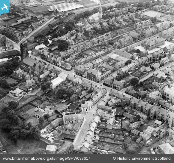
SPW033617 SCOTLAND (1930). Kirkintilloch, general view, showing Cowgate and Kerr Street. An oblique aerial photograph taken facing south.
© Copyright OpenStreetMap contributors and licensed by the OpenStreetMap Foundation. 2024. Cartography is licensed as CC BY-SA.
Nearby Images (7)
SPW033617

SPW033615

SPW033616

SPW056743

SPW056742

SPW033618

SPW033619

Details
| Title | [SPW033617] Kirkintilloch, general view, showing Cowgate and Kerr Street. An oblique aerial photograph taken facing south. |
| Reference | SPW033617 |
| Date | 1930 |
| Link | Canmore Collection item 1259373 |
| Place name | |
| Parish | KIRKINTILLOCH (STRATHKELVIN) |
| District | STRATHKELVIN |
| Country | SCOTLAND |
| Easting / Northing | 265400, 673900 |
| Longitude / Latitude | -4.1551871247289, 55.939314647545 |
| National Grid Reference | NS654739 |
Pins
Be the first to add a comment to this image!