
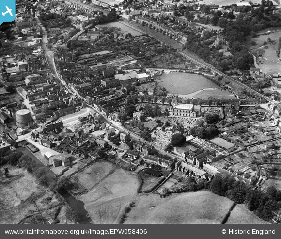
EPW058406 ENGLAND (1938). St Michael's Church and environs, Stone, 1938
© Copyright OpenStreetMap contributors and licensed by the OpenStreetMap Foundation. 2024. Cartography is licensed as CC BY-SA.
Nearby Images (20)
EPW058406

EPW026988

EPW053350

EPW026987

EPW058365

EPW058366

EPW047679

EPW026986

EPW042625

EPW058367

EPW042626

EPW042624

EPW058372

EPW058369

EPW058368

EPW058371

EPW058404

EPW058370

EPW020071

EPW026981

Details
| Title | [EPW058406] St Michael's Church and environs, Stone, 1938 |
| Reference | EPW058406 |
| Date | 28-July-1938 |
| Link | |
| Place name | STONE |
| Parish | STONE |
| District | |
| Country | ENGLAND |
| Easting / Northing | 390402, 333778 |
| Longitude / Latitude | -2.1427058533599, 52.901035997747 |
| National Grid Reference | SJ904338 |
Pins
 MB |
Wednesday 8th of January 2014 09:32:27 PM | |
MB |
Wednesday 8th of January 2014 09:29:34 PM | |
MB |
Wednesday 8th of January 2014 09:29:00 PM | |
MB |
Wednesday 8th of January 2014 09:28:24 PM | |
MB |
Wednesday 8th of January 2014 09:27:19 PM |


