
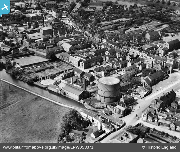
EPW058371 ENGLAND (1938). The town Gas Works, Stone, 1938
© Copyright OpenStreetMap contributors and licensed by the OpenStreetMap Foundation. 2024. Cartography is licensed as CC BY-SA.
Nearby Images (25)
EPW058371

EPW058370

EPW058368

EPW026986

EPW058367

EPW058366

EPW058372

EPW020071

EPW058369

EPW042624

EPW058365

EPW042625

EPW042626

EPW047679

EPW058404

EPW042628

EPW042629

EPW042627

EPW053350

EPW026981

EPW058406

EPW026984

EPW026988

EPW058407

EPW026985

Details
| Title | [EPW058371] The town Gas Works, Stone, 1938 |
| Reference | EPW058371 |
| Date | 28-July-1938 |
| Link | |
| Place name | STONE |
| Parish | STONE |
| District | |
| Country | ENGLAND |
| Easting / Northing | 390214, 333780 |
| Longitude / Latitude | -2.1455011424847, 52.901050587884 |
| National Grid Reference | SJ902338 |
Pins
Be the first to add a comment to this image!


