
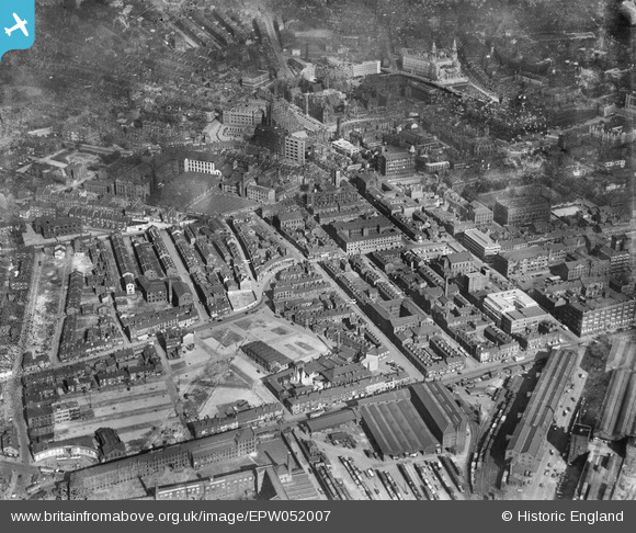
EPW052007 ENGLAND (1936). West Street and environs showing building clearance in advance of new road construction, Leeds, 1936
© Copyright OpenStreetMap contributors and licensed by the OpenStreetMap Foundation. 2024. Cartography is licensed as CC BY-SA.
Nearby Images (13)
EPW052007

EPW052006

EPW052005

EPW052002

EPW052001

EPW052016

EPW052014

EPW052015

EPW052018

EPW052017

EPW052003

EAW015742

EPW052004

Details
| Title | [EPW052007] West Street and environs showing building clearance in advance of new road construction, Leeds, 1936 |
| Reference | EPW052007 |
| Date | October-1936 |
| Link | |
| Place name | LEEDS |
| Parish | |
| District | |
| Country | ENGLAND |
| Easting / Northing | 429357, 433712 |
| Longitude / Latitude | -1.5542438037405, 53.798668834801 |
| National Grid Reference | SE294337 |
Pins
Be the first to add a comment to this image!


