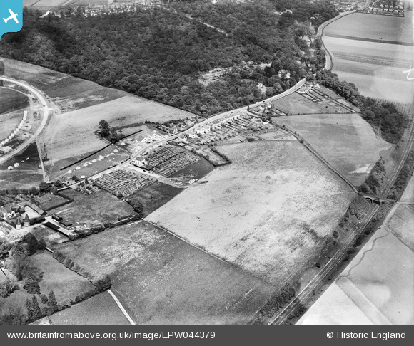
EPW044379 ENGLAND (1934). Hurst Road and environs, Bexley Woods, 1934
© Copyright OpenStreetMap contributors and licensed by the OpenStreetMap Foundation. 2024. Cartography is licensed as CC BY-SA.
Nearby Images (10)
Details
| Title | [EPW044379] Hurst Road and environs, Bexley Woods, 1934 |
| Reference | EPW044379 |
| Date | May-1934 |
| Link | |
| Place name | BEXLEY WOODS |
| Parish | |
| District | |
| Country | ENGLAND |
| Easting / Northing | 548050, 173120 |
| Longitude / Latitude | 0.13028176191216, 51.437213671474 |
| National Grid Reference | TQ481731 |
Pins
Be the first to add a comment to this image!


![[EPW044379] Hurst Road and environs, Bexley Woods, 1934](http://britainfromabove.org.uk/sites/all/libraries/aerofilms-images/public/100x100/EPW/044/EPW044379.jpg)
![[EPW044378] Hurst Road and environs, Bexley Woods, 1934](http://britainfromabove.org.uk/sites/all/libraries/aerofilms-images/public/100x100/EPW/044/EPW044378.jpg)
![[EPW044377] Hurst Road and environs, Bexley Woods, 1934](http://britainfromabove.org.uk/sites/all/libraries/aerofilms-images/public/100x100/EPW/044/EPW044377.jpg)
![[EPW044736] Hurst Road, Valentine Avenue, the SR Dartford Loop and environs, Bexley Woods, 1934](http://britainfromabove.org.uk/sites/all/libraries/aerofilms-images/public/100x100/EPW/044/EPW044736.jpg)
![[EPW044734] Hurst Road, the SR Dartford Loop and environs, Bexley Woods, 1934](http://britainfromabove.org.uk/sites/all/libraries/aerofilms-images/public/100x100/EPW/044/EPW044734.jpg)
![[EPW044735] Hurst Road, the SR Dartford Loop and environs, Bexley Woods, 1934](http://britainfromabove.org.uk/sites/all/libraries/aerofilms-images/public/100x100/EPW/044/EPW044735.jpg)
![[EPW044376] The SR Dartford Loop Line and housing under construction to the north of Hurst Road along Dorchester Avenue and Murchison Avenue, Bexley Woods, 1934](http://britainfromabove.org.uk/sites/all/libraries/aerofilms-images/public/100x100/EPW/044/EPW044376.jpg)
![[EPW044732] Hurst Road, the SR Dartford Loop and environs, Bexley Woods, 1934](http://britainfromabove.org.uk/sites/all/libraries/aerofilms-images/public/100x100/EPW/044/EPW044732.jpg)
![[EPW044733] Hurst Place and environs, Sidcup, 1934](http://britainfromabove.org.uk/sites/all/libraries/aerofilms-images/public/100x100/EPW/044/EPW044733.jpg)
![[EPW044718] The Albany Park Estate under construction centred upon Murchison, Dorchester and Crofton Avenues, Bexley Woods, from the south-east, 1934](http://britainfromabove.org.uk/sites/all/libraries/aerofilms-images/public/100x100/EPW/044/EPW044718.jpg)


