
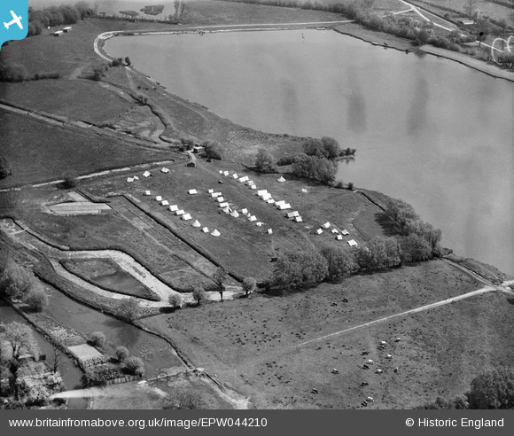
EPW044210 ENGLAND (1934). Campsite adjacent to Bury Lake, Rickmansworth, 1934
© Copyright OpenStreetMap contributors and licensed by the OpenStreetMap Foundation. 2024. Cartography is licensed as CC BY-SA.
Nearby Images (4)
EPW044210

EPW044209

EAW026494

EAW026493

Details
| Title | [EPW044210] Campsite adjacent to Bury Lake, Rickmansworth, 1934 |
| Reference | EPW044210 |
| Date | May-1934 |
| Link | |
| Place name | RICKMANSWORTH |
| Parish | |
| District | |
| Country | ENGLAND |
| Easting / Northing | 505107, 193908 |
| Longitude / Latitude | -0.48113421386593, 51.633681634217 |
| National Grid Reference | TQ051939 |
Pins
 Lucy |
Thursday 24th of September 2020 05:25:20 PM | |
Lucy |
Thursday 24th of September 2020 05:19:48 PM | |
Lucy |
Thursday 24th of September 2020 05:17:55 PM | |
LesMead |
Thursday 16th of May 2013 11:26:12 AM | |
LesMead |
Wednesday 8th of May 2013 11:49:00 AM | |
LesMead |
Wednesday 8th of May 2013 11:48:02 AM |


