
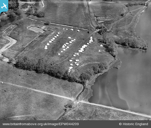
EPW044209 ENGLAND (1934). Campsite adjacent to Bury Lake, Rickmansworth, 1934
© Copyright OpenStreetMap contributors and licensed by the OpenStreetMap Foundation. 2024. Cartography is licensed as CC BY-SA.
Nearby Images (4)
EPW044209

EPW044210

EAW026494

EAW026493

Details
| Title | [EPW044209] Campsite adjacent to Bury Lake, Rickmansworth, 1934 |
| Reference | EPW044209 |
| Date | May-1934 |
| Link | |
| Place name | RICKMANSWORTH |
| Parish | |
| District | |
| Country | ENGLAND |
| Easting / Northing | 505074, 193881 |
| Longitude / Latitude | -0.4816190111214, 51.633445093509 |
| National Grid Reference | TQ051939 |
Pins
 This is six |
Monday 7th of April 2014 02:37:08 PM |


