
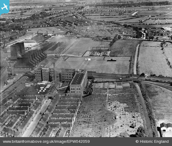
EPW042059 ENGLAND (1933). The Needlers Ltd Confectionery Works and environs, Sculcoates, from the south-east, 1933
© Copyright OpenStreetMap contributors and licensed by the OpenStreetMap Foundation. 2024. Cartography is licensed as CC BY-SA.
Nearby Images (18)
EPW042059

EPW042060

EPW042058

EPW036498

EPW042055

EPW042057

EPW006337

EPW006343

EAW030290

EPW006342

EAW030288

EPW006347

EPW006348

EPW006339

EPW006346

EPW006344

EPW042056

EPW006341

Details
| Title | [EPW042059] The Needlers Ltd Confectionery Works and environs, Sculcoates, from the south-east, 1933 |
| Reference | EPW042059 |
| Date | June-1933 |
| Link | |
| Place name | SCULCOATES |
| Parish | |
| District | |
| Country | ENGLAND |
| Easting / Northing | 509385, 430918 |
| Longitude / Latitude | -0.34044732706514, 53.762894797898 |
| National Grid Reference | TA094309 |
Pins
 John Wass |
Friday 28th of August 2015 11:15:19 AM |


