
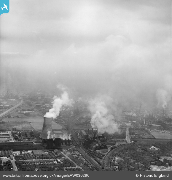
EAW030290 ENGLAND (1950). Sculcoates Power Station and environs, Sculcoates, from the west, 1950
© Copyright OpenStreetMap contributors and licensed by the OpenStreetMap Foundation. 2024. Cartography is licensed as CC BY-SA.
Nearby Images (17)
EAW030290

EPW006342

EPW042057

EPW042055

EPW006347

EPW006339

EPW036498

EPW006346

EPW006348

EPW042060

EPW042058

EPW042059

EPW006341

EPW006343

EPW042056

EPW006337

EAW030288

Details
| Title | [EAW030290] Sculcoates Power Station and environs, Sculcoates, from the west, 1950 |
| Reference | EAW030290 |
| Date | 13-June-1950 |
| Link | |
| Place name | SCULCOATES |
| Parish | |
| District | |
| Country | ENGLAND |
| Easting / Northing | 509265, 430980 |
| Longitude / Latitude | -0.34224513977751, 53.763477069752 |
| National Grid Reference | TA093310 |
Pins
Be the first to add a comment to this image!


