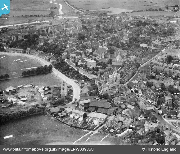
EPW039358 ENGLAND (1932). The Land Gate, East Cliff and the town, Rye, 1932
© Copyright OpenStreetMap contributors and licensed by the OpenStreetMap Foundation. 2024. Cartography is licensed as CC BY-SA.
Nearby Images (8)
Details
| Title | [EPW039358] The Land Gate, East Cliff and the town, Rye, 1932 |
| Reference | EPW039358 |
| Date | July-1932 |
| Link | |
| Place name | RYE |
| Parish | RYE |
| District | |
| Country | ENGLAND |
| Easting / Northing | 592209, 120556 |
| Longitude / Latitude | 0.73684792736781, 50.951792073887 |
| National Grid Reference | TQ922206 |
Pins
 glennhughz |
Wednesday 9th of April 2014 05:39:33 PM | |
 AndrewGVT |
Thursday 5th of December 2013 03:56:50 PM | |
 AndrewGVT |
Thursday 5th of December 2013 03:56:10 PM | |
 AndrewGVT |
Thursday 5th of December 2013 03:53:57 PM | |
 SteveAUS |
Wednesday 27th of February 2013 04:48:30 AM | |
 Class31 |
Thursday 24th of January 2013 10:08:01 PM |


![[EPW039358] The Land Gate, East Cliff and the town, Rye, 1932](http://britainfromabove.org.uk/sites/all/libraries/aerofilms-images/public/100x100/EPW/039/EPW039358.jpg)
![[EPW026243] East Cliff, the Land Gate and environs, Rye, 1929](http://britainfromabove.org.uk/sites/all/libraries/aerofilms-images/public/100x100/EPW/026/EPW026243.jpg)
![[EPW026240] The Land Gate and environs, Rye, 1929](http://britainfromabove.org.uk/sites/all/libraries/aerofilms-images/public/100x100/EPW/026/EPW026240.jpg)
![[EPW000159] Market Road and environs, Rye, from the east, 1920](http://britainfromabove.org.uk/sites/all/libraries/aerofilms-images/public/100x100/EPW/000/EPW000159.jpg)
![[EPW026236] Tower Street and environs, Rye, 1929](http://britainfromabove.org.uk/sites/all/libraries/aerofilms-images/public/100x100/EPW/026/EPW026236.jpg)
![[EPW035354] The Land Gate and the town, Rye, 1931](http://britainfromabove.org.uk/sites/all/libraries/aerofilms-images/public/100x100/EPW/035/EPW035354.jpg)
![[EPW000127] Middle Salts, Rye, 1920](http://britainfromabove.org.uk/sites/all/libraries/aerofilms-images/public/100x100/EPW/000/EPW000127.jpg)
![[EPW039360] The town centre, Rye, 1932](http://britainfromabove.org.uk/sites/all/libraries/aerofilms-images/public/100x100/EPW/039/EPW039360.jpg)