
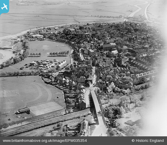
EPW035354 ENGLAND (1931). The Land Gate and the town, Rye, 1931
© Copyright OpenStreetMap contributors and licensed by the OpenStreetMap Foundation. 2024. Cartography is licensed as CC BY-SA.
Nearby Images (8)
EPW035354

EPW026236

EPW000159

EPW026240

EPW000127

EPW026243

EPW039358

EPW039360

Details
| Title | [EPW035354] The Land Gate and the town, Rye, 1931 |
| Reference | EPW035354 |
| Date | 25-May-1931 |
| Link | |
| Place name | RYE |
| Parish | RYE |
| District | |
| Country | ENGLAND |
| Easting / Northing | 592230, 120637 |
| Longitude / Latitude | 0.73718935124374, 50.952512699502 |
| National Grid Reference | TQ922206 |
Pins
 Max Beadle |
Sunday 10th of January 2021 09:11:00 PM | |
glennhughz |
Wednesday 9th of April 2014 05:33:59 PM | |
 Class31 |
Thursday 24th of January 2013 10:04:43 PM |


