
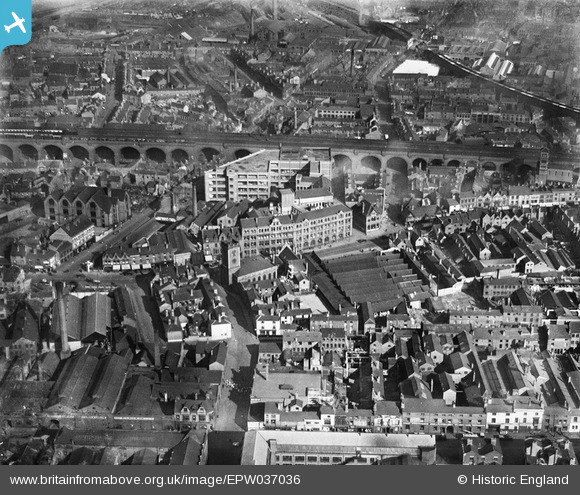
EPW037036 ENGLAND (1931). The Devonshire Works, railway viaduct and environs, Deritend, 1931
© Copyright OpenStreetMap contributors and licensed by the OpenStreetMap Foundation. 2025. Cartography is licensed as CC BY-SA.
Nearby Images (15)
EPW037036

EPW037037

EPW037035

EPW037038

EPW037039

EPW037040

EPW005841

EPW050089

EPW050088

EPW050371

EPW050087

EPW053097

EPW050372

EPW050370

EPW050091

Details
| Title | [EPW037036] The Devonshire Works, railway viaduct and environs, Deritend, 1931 |
| Reference | EPW037036 |
| Date | 17-October-1931 |
| Link | |
| Place name | DERITEND |
| Parish | |
| District | |
| Country | ENGLAND |
| Easting / Northing | 407925, 286321 |
| Longitude / Latitude | -1.8833116638927, 52.474392914964 |
| National Grid Reference | SP079863 |
Pins
 martbien |
Wednesday 22nd of January 2020 12:52:57 PM | |
kevofbrum |
Wednesday 5th of October 2016 11:06:49 PM | |
kevofbrum |
Wednesday 5th of October 2016 11:04:52 PM | |
kevofbrum |
Wednesday 5th of October 2016 11:04:19 PM | |
kevofbrum |
Wednesday 5th of October 2016 11:03:35 PM | |
kevofbrum |
Wednesday 5th of October 2016 11:02:57 PM | |
kevofbrum |
Wednesday 5th of October 2016 11:02:22 PM | |
kevofbrum |
Wednesday 5th of October 2016 11:01:29 PM | |
kevofbrum |
Wednesday 5th of October 2016 11:00:58 PM | |
kevofbrum |
Wednesday 5th of October 2016 11:00:16 PM | |
kevofbrum |
Wednesday 5th of October 2016 10:59:53 PM | |
kevofbrum |
Wednesday 5th of October 2016 10:59:03 PM | |
kevofbrum |
Wednesday 5th of October 2016 10:57:45 PM |