
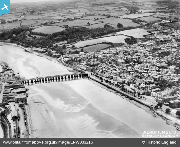
EPW033216 ENGLAND (1930). Bideford Bridge, Bideford, 1930. This image has been produced from a copy-negative.
© Copyright OpenStreetMap contributors and licensed by the OpenStreetMap Foundation. 2024. Cartography is licensed as CC BY-SA.
Nearby Images (9)
EPW033216

EPW039894

EAW007550

EPW033218

EAW031034

EAW053028

EPW039893

EPW059675

EPW039892

Details
| Title | [EPW033216] Bideford Bridge, Bideford, 1930. This image has been produced from a copy-negative. |
| Reference | EPW033216 |
| Date | July-1930 |
| Link | |
| Place name | BIDEFORD |
| Parish | BIDEFORD |
| District | |
| Country | ENGLAND |
| Easting / Northing | 245438, 126456 |
| Longitude / Latitude | -4.2037805900509, 51.01614172597 |
| National Grid Reference | SS454265 |
Pins
 Keeley Hall |
Friday 15th of March 2024 11:49:12 AM | |
Keeley Hall |
Friday 15th of March 2024 10:18:42 AM |