
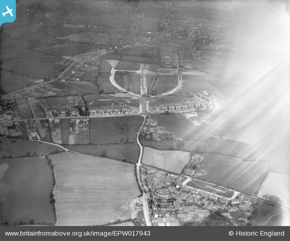
EPW017943 ENGLAND (1927). Coalway Road and the Oxbarn Avenue housing estate under construction, Merry Hill, 1927
© Copyright OpenStreetMap contributors and licensed by the OpenStreetMap Foundation. 2024. Cartography is licensed as CC BY-SA.
Nearby Images (9)
EPW017943

EPW017946

EPW017941

EPW017948

EPW017945

EPW017944

EPW017942

EPW017939

EPW017947

Details
| Title | [EPW017943] Coalway Road and the Oxbarn Avenue housing estate under construction, Merry Hill, 1927 |
| Reference | EPW017943 |
| Date | 11-May-1927 |
| Link | |
| Place name | MERRY HILL |
| Parish | |
| District | |
| Country | ENGLAND |
| Easting / Northing | 389057, 296898 |
| Longitude / Latitude | -2.1614737531418, 52.569437577841 |
| National Grid Reference | SO891969 |
Pins
 Class31 |
Friday 9th of November 2012 09:26:11 PM | |
Class31 |
Friday 9th of November 2012 09:25:39 PM | |
Class31 |
Friday 9th of November 2012 09:25:08 PM | |
Class31 |
Friday 9th of November 2012 09:24:29 PM | |
Class31 |
Friday 9th of November 2012 09:24:03 PM | |
 Sligs |
Friday 13th of July 2012 11:41:37 PM | |
Sligs |
Friday 13th of July 2012 11:39:14 PM | |
Sligs |
Friday 13th of July 2012 11:36:29 PM |
User Comment Contributions
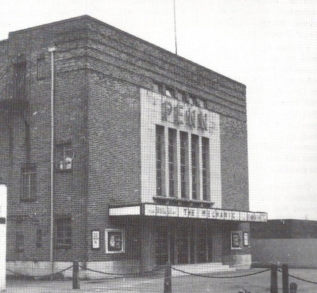 For anyone interested, this is what Penn Cinema looked like. It was demolished in March 1973. |
Sligs |
Friday 13th of July 2012 11:48:50 PM |


