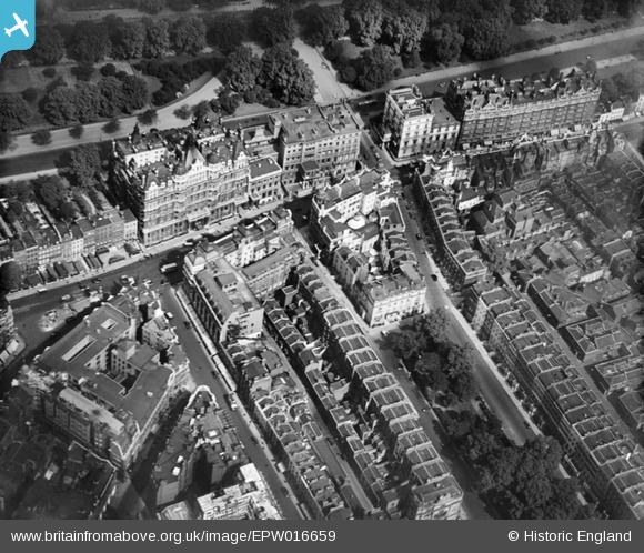
EPW016659 ENGLAND (1926). Seville Street and environs, Brompton, 1926
© Copyright OpenStreetMap contributors and licensed by the OpenStreetMap Foundation. 2024. Cartography is licensed as CC BY-SA.
Nearby Images (6)
EPW016659

EPW045420

EPW016661

EAW022138

EPW016660

EAW000555

Details
| Title | [EPW016659] Seville Street and environs, Brompton, 1926 |
| Reference | EPW016659 |
| Date | August-1926 |
| Link | |
| Place name | BROMPTON |
| Parish | |
| District | |
| Country | ENGLAND |
| Easting / Northing | 527863, 179698 |
| Longitude / Latitude | -0.1576332905625, 51.501253310539 |
| National Grid Reference | TQ279797 |
Pins
 Class31 |
Wednesday 24th of September 2014 07:55:54 AM |