
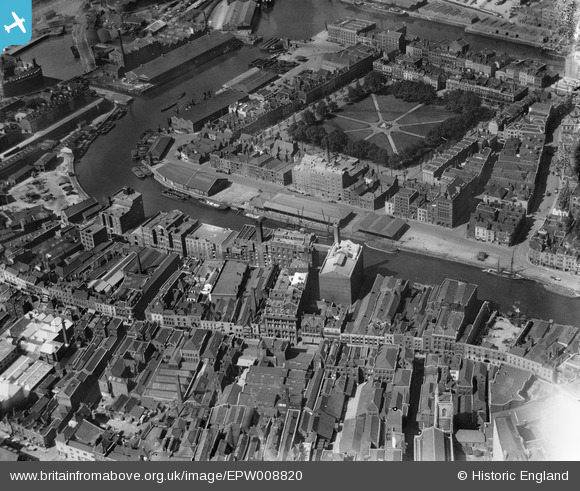
EPW008820 ENGLAND (1923). Redcliffe Wharf and Queen Square, Bristol, 1923
© Copyright OpenStreetMap contributors and licensed by the OpenStreetMap Foundation. 2024. Cartography is licensed as CC BY-SA.
Nearby Images (23)
EPW008820

EPW008819

EPW008826A

EPW008822

EPW008824

EPW008825

EPW008823

EPW008826

EPW008821

EAW026795

EAW032261

EAW032260

EAW032255

EAW000738

EAW032258

EAW032254

EPR000085

EAW032257

EAW032259

EAW032256

EAW000739

EPW005476

EAW026794

Details
| Title | [EPW008820] Redcliffe Wharf and Queen Square, Bristol, 1923 |
| Reference | EPW008820 |
| Date | 1923 |
| Link | |
| Place name | BRISTOL |
| Parish | |
| District | |
| Country | ENGLAND |
| Easting / Northing | 358993, 172586 |
| Longitude / Latitude | -2.590187617014, 51.450283017654 |
| National Grid Reference | ST590726 |
Pins

User Comment Contributions
 Llandoger Trow 20/2/2014 |
 Class31 |
Sunday 2nd of March 2014 11:21:33 AM |


