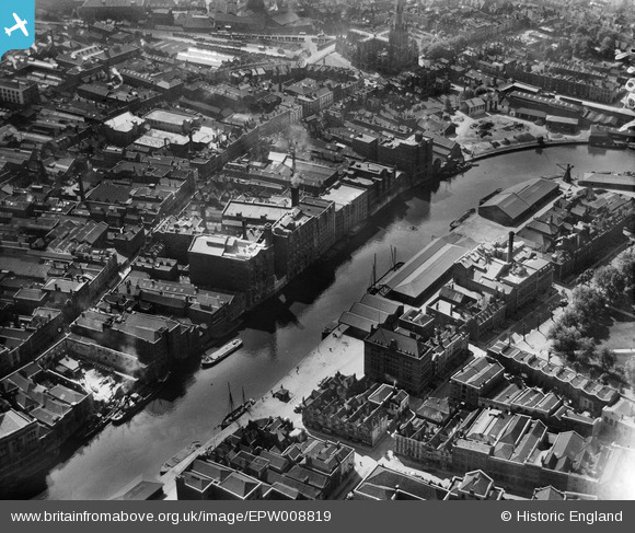
EPW008819 ENGLAND (1923). Redcliffe Wharf, Bristol, 1923
© Copyright OpenStreetMap contributors and licensed by the OpenStreetMap Foundation. 2024. Cartography is licensed as CC BY-SA.
Nearby Images (22)
EPW008819

EPW008820

EPW008826A

EPW008822

EPW008825

EPW008823

EPW008826

EPW008824

EPW008821

EAW026795

EAW032261

EAW032260

EAW032255

EAW000738

EAW032258

EAW032254

EPR000085

EAW032257

EAW032259

EAW032256

EAW000739

EAW026794

Details
| Title | [EPW008819] Redcliffe Wharf, Bristol, 1923 |
| Reference | EPW008819 |
| Date | 1923 |
| Link | |
| Place name | BRISTOL |
| Parish | |
| District | |
| Country | ENGLAND |
| Easting / Northing | 358992, 172596 |
| Longitude / Latitude | -2.5902031679904, 51.45037286627 |
| National Grid Reference | ST590726 |
Pins
 Braikenridge |
Saturday 17th of August 2013 06:38:02 PM | |
 Class31 |
Monday 24th of June 2013 05:10:15 PM | |
Class31 |
Monday 24th of June 2013 05:09:48 PM | |
Class31 |
Monday 24th of June 2013 05:09:14 PM | |
Class31 |
Saturday 18th of May 2013 08:46:51 PM |