
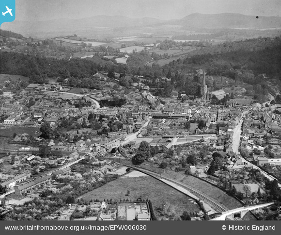
EPW006030 ENGLAND (1921). The town centre, Ledbury, from the west, 1921
© Copyright OpenStreetMap contributors and licensed by the OpenStreetMap Foundation. 2024. Cartography is licensed as CC BY-SA.
Nearby Images (4)
EPW006030

EPW029977

EPW029972

EPW029974

Details
| Title | [EPW006030] The town centre, Ledbury, from the west, 1921 |
| Reference | EPW006030 |
| Date | 30-April-1921 |
| Link | |
| Place name | LEDBURY |
| Parish | LEDBURY |
| District | |
| Country | ENGLAND |
| Easting / Northing | 370867, 237598 |
| Longitude / Latitude | -2.4247453573558, 52.035599395569 |
| National Grid Reference | SO709376 |
Pins
 Mike |
Wednesday 26th of July 2023 07:29:46 PM | |
Mike |
Wednesday 26th of July 2023 07:17:46 PM | |
Mike |
Wednesday 26th of July 2023 07:00:49 PM | |
Mike |
Wednesday 26th of July 2023 06:53:24 PM | |
Mike |
Wednesday 26th of July 2023 06:22:45 PM | |
Mr Jauncey |
Saturday 14th of July 2012 11:48:42 AM | |
Continued on to Gloucester Central station. Closed in 1959, prior to the Beeching cuts of the 1960s. |
John W |
Tuesday 13th of September 2016 05:49:11 PM |
sjl |
Friday 29th of June 2012 01:35:39 PM |


