
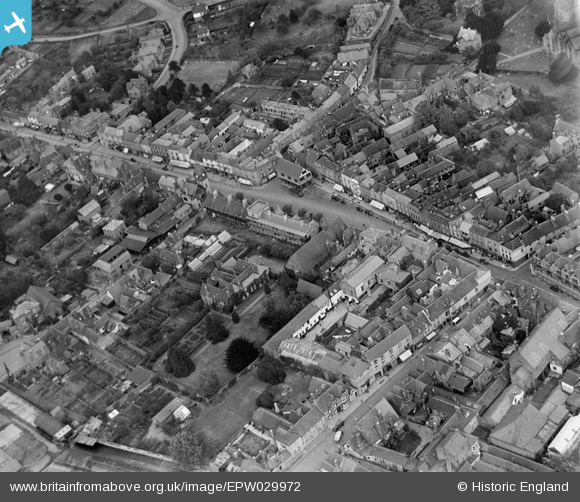
EPW029972 ENGLAND (1929). The High Street, Ledbury, 1929
© Copyright OpenStreetMap contributors and licensed by the OpenStreetMap Foundation. 2024. Cartography is licensed as CC BY-SA.
Nearby Images (7)
EPW029972

EPW029974

EPW006031

EPW029973

EPW029977

EPW029968

EPW006030

Details
| Title | [EPW029972] The High Street, Ledbury, 1929 |
| Reference | EPW029972 |
| Date | September-1929 |
| Link | |
| Place name | LEDBURY |
| Parish | LEDBURY |
| District | |
| Country | ENGLAND |
| Easting / Northing | 371077, 237667 |
| Longitude / Latitude | -2.4216895838996, 52.036230801115 |
| National Grid Reference | SO711377 |
Pins
 John W |
Tuesday 13th of September 2016 05:55:07 PM | |
Sylvia P |
Tuesday 8th of March 2016 10:37:04 PM | |
Sylvia P |
Tuesday 8th of March 2016 10:36:29 PM | |
Sylvia P |
Tuesday 8th of March 2016 10:35:56 PM |


