
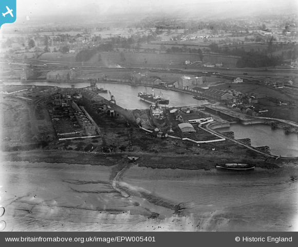
EPW005401 ENGLAND (1921). The Dock Basin, lock and Tidal Basin, Sharpness, 1921
© Copyright OpenStreetMap contributors and licensed by the OpenStreetMap Foundation. 2024. Cartography is licensed as CC BY-SA.
Nearby Images (12)
EPW005401

EAW012138

EAW012141

EPW029346

EAW012140

EPW029343

EPW029344

EPW029349

EPW037753

EPW029348

EAW006849

EPW037754

Details
| Title | [EPW005401] The Dock Basin, lock and Tidal Basin, Sharpness, 1921 |
| Reference | EPW005401 |
| Date | March-1921 |
| Link | |
| Place name | SHARPNESS |
| Parish | HINTON |
| District | |
| Country | ENGLAND |
| Easting / Northing | 366957, 202370 |
| Longitude / Latitude | -2.4783758285865, 51.718623593435 |
| National Grid Reference | SO670024 |
Pins
 Louis |
Saturday 19th of January 2013 05:24:06 PM | |
Louis |
Saturday 19th of January 2013 05:23:27 PM | |
 Class31 |
Tuesday 16th of October 2012 08:38:16 PM | |
Class31 |
Tuesday 16th of October 2012 08:37:24 PM | |
Class31 |
Tuesday 16th of October 2012 08:36:56 PM | |
Class31 |
Tuesday 16th of October 2012 08:35:23 PM | |
Class31 |
Tuesday 16th of October 2012 08:35:07 PM | |
Class31 |
Tuesday 16th of October 2012 08:33:56 PM |
User Comment Contributions
 Sharpness Dock, 09/08/2015 |
Class31 |
Monday 10th of August 2015 08:31:36 AM |
View looking east. |
Class31 |
Tuesday 16th of October 2012 08:35:54 PM |
 Southern terminus of the Gloucester & Sharpness Canal |
Richard Fairhurst |
Monday 9th of July 2012 11:50:06 AM |