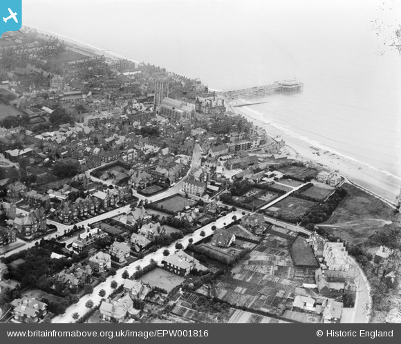
EPW001816 ENGLAND (1920). View of Cromer, the pier and St Peter and St Paul's Church, Cromer, 1920
© Copyright OpenStreetMap contributors and licensed by the OpenStreetMap Foundation. 2024. Cartography is licensed as CC BY-SA.
Nearby Images (8)
EPW001816

EPW001811

EAW051641

EAW051642

EPW021227

EAW051640

EPW001812

EAW051646

Details
| Title | [EPW001816] View of Cromer, the pier and St Peter and St Paul's Church, Cromer, 1920 |
| Reference | EPW001816 |
| Date | June-1920 |
| Link | |
| Place name | CROMER |
| Parish | CROMER |
| District | |
| Country | ENGLAND |
| Easting / Northing | 622090, 342075 |
| Longitude / Latitude | 1.3047823395529, 52.929747077134 |
| National Grid Reference | TG221421 |
Pins
 Cyberbia |
Friday 20th of September 2024 08:10:59 PM | |
 Alan McFaden |
Monday 22nd of July 2013 10:05:07 AM | |
Alan McFaden |
Monday 22nd of July 2013 10:04:22 AM | |
Alan McFaden |
Monday 22nd of July 2013 10:02:28 AM | |
Alan McFaden |
Monday 22nd of July 2013 10:01:52 AM | |
Alan McFaden |
Monday 22nd of July 2013 10:01:24 AM | |
Alan McFaden |
Monday 22nd of July 2013 10:00:41 AM | |
Alan McFaden |
Monday 22nd of July 2013 10:00:05 AM | |
 Class31 |
Monday 3rd of September 2012 09:11:09 PM | |
Class31 |
Monday 3rd of September 2012 09:10:42 PM | |
Class31 |
Monday 3rd of September 2012 09:10:15 PM |