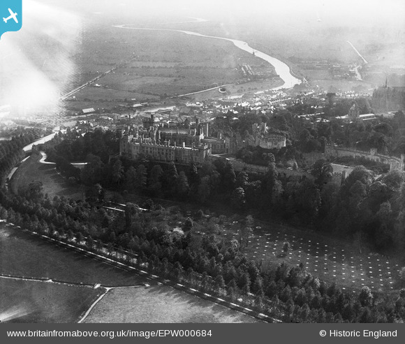
EPW000684 ENGLAND (1920). Arundel Castle, Arundel, from the north, 1920
© Copyright OpenStreetMap contributors and licensed by the OpenStreetMap Foundation. 2024. Cartography is licensed as CC BY-SA.
Nearby Images (10)
EPW000684

EAW021570

EAW021571

EAW050661

EPW000726

EAW050663

EAW021569

EPW018264

EAW050664

EPW000686

Details
| Title | [EPW000684] Arundel Castle, Arundel, from the north, 1920 |
| Reference | EPW000684 |
| Date | April-1920 |
| Link | |
| Place name | ARUNDEL |
| Parish | ARUNDEL |
| District | |
| Country | ENGLAND |
| Easting / Northing | 501930, 107507 |
| Longitude / Latitude | -0.55163734464471, 50.857523707879 |
| National Grid Reference | TQ019075 |
Pins
 Alan McFaden |
Sunday 18th of May 2014 04:58:06 PM | |
Alan McFaden |
Sunday 18th of May 2014 04:50:55 PM | |
Alan McFaden |
Sunday 18th of May 2014 04:48:55 PM | |
Alan McFaden |
Sunday 18th of May 2014 04:48:12 PM | |
Alan McFaden |
Sunday 18th of May 2014 04:42:30 PM |