
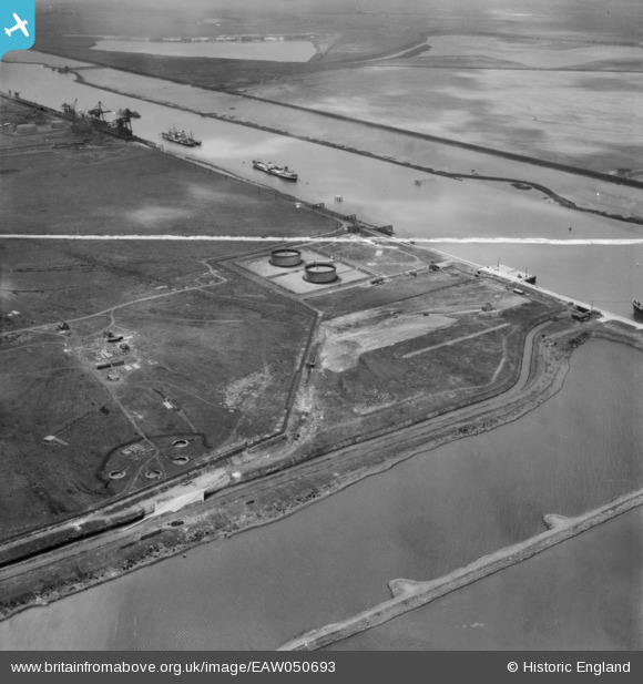
EAW050693 ENGLAND (1953). The River Tees, Teesport Oil Depot and nearby gun emplacements, Teesport, 1953. This image was marked by Aerofilms Ltd for photo editing.
© Copyright OpenStreetMap contributors and licensed by the OpenStreetMap Foundation. 2025. Cartography is licensed as CC BY-SA.
Nearby Images (8)
EAW050693

EAW050692

EAW050694

EAW050687

EAW050688

EAW051066

EAW050695

EAW051067

Details
| Title | [EAW050693] The River Tees, Teesport Oil Depot and nearby gun emplacements, Teesport, 1953. This image was marked by Aerofilms Ltd for photo editing. |
| Reference | EAW050693 |
| Date | 15-July-1953 |
| Link | |
| Place name | TEESPORT |
| Parish | |
| District | |
| Country | ENGLAND |
| Easting / Northing | 454222, 523046 |
| Longitude / Latitude | -1.1606115367411, 54.599557854082 |
| National Grid Reference | NZ542230 |
Pins
 redmist |
Sunday 28th of November 2021 04:45:43 PM | |
redmist |
Sunday 28th of November 2021 04:43:22 PM | |
redmist |
Sunday 28th of November 2021 04:41:12 PM | |
redmist |
Sunday 28th of November 2021 04:40:13 PM | |
redmist |
Sunday 28th of November 2021 04:39:03 PM | |
redmist |
Sunday 28th of November 2021 04:37:31 PM | |
redmist |
Sunday 28th of November 2021 04:36:31 PM | |
redmist |
Monday 28th of October 2019 10:34:46 AM | |
redmist |
Monday 28th of October 2019 10:33:59 AM | |
redmist |
Monday 28th of October 2019 10:33:44 AM | |
redmist |
Monday 28th of October 2019 10:32:50 AM |