
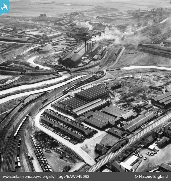
EAW049662 ENGLAND (1953). The industrial landscape of New York, Ickles and Templeborough, Rotherham, 1953
© Copyright OpenStreetMap contributors and licensed by the OpenStreetMap Foundation. 2024. Cartography is licensed as CC BY-SA.
Nearby Images (18)
EAW049662

EAW048631

EAW049658

EAW048649

EAW048632

EAW048634

EAW049661

EAW049657

EAW049660

EAW048635

EAW048629

EAW048633

EAW048637

EAW048630

EAW048638

EAW048636

EAW049659

EAW024146

Details
| Title | [EAW049662] The industrial landscape of New York, Ickles and Templeborough, Rotherham, 1953 |
| Reference | EAW049662 |
| Date | 24-May-1953 |
| Link | |
| Place name | ROTHERHAM |
| Parish | |
| District | |
| Country | ENGLAND |
| Easting / Northing | 442174, 392350 |
| Longitude / Latitude | -1.3652429337612, 53.425995564882 |
| National Grid Reference | SK422924 |
Pins
 Steeples |
Thursday 1st of December 2016 08:17:47 PM | |
Holmes Junction |
Wednesday 23rd of November 2016 03:18:49 PM | |
Holmes Junction |
Wednesday 23rd of November 2016 03:17:28 PM | |
Holmes Junction |
Wednesday 23rd of November 2016 03:17:04 PM | |
Holmes Junction |
Wednesday 23rd of November 2016 03:14:48 PM |


