
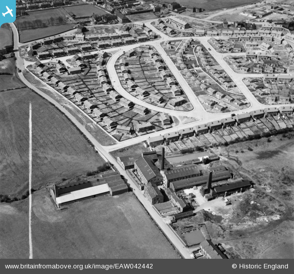
EAW042442 ENGLAND (1952). The residential area surrounding Walnut Road and the Fitton & Sons Pildacre Shoddy Mill, Chickenley, 1952. This image was marked by Aerofilms Ltd for photo editing.
© Copyright OpenStreetMap contributors and licensed by the OpenStreetMap Foundation. 2024. Cartography is licensed as CC BY-SA.
Nearby Images (12)
EAW042442

EAW042434

EAW050296

EAW042435

EAW042430

EAW042436

EAW042438

EAW042432

EAW042441

EAW042439

EAW042437

EAW050300

Details
| Title | [EAW042442] The residential area surrounding Walnut Road and the Fitton & Sons Pildacre Shoddy Mill, Chickenley, 1952. This image was marked by Aerofilms Ltd for photo editing. |
| Reference | EAW042442 |
| Date | 17-April-1952 |
| Link | |
| Place name | CHICKENLEY |
| Parish | |
| District | |
| Country | ENGLAND |
| Easting / Northing | 426588, 420937 |
| Longitude / Latitude | -1.5973861410888, 53.683984843298 |
| National Grid Reference | SE266209 |
Pins
 Linda |
Tuesday 30th of July 2019 11:43:37 PM |


