
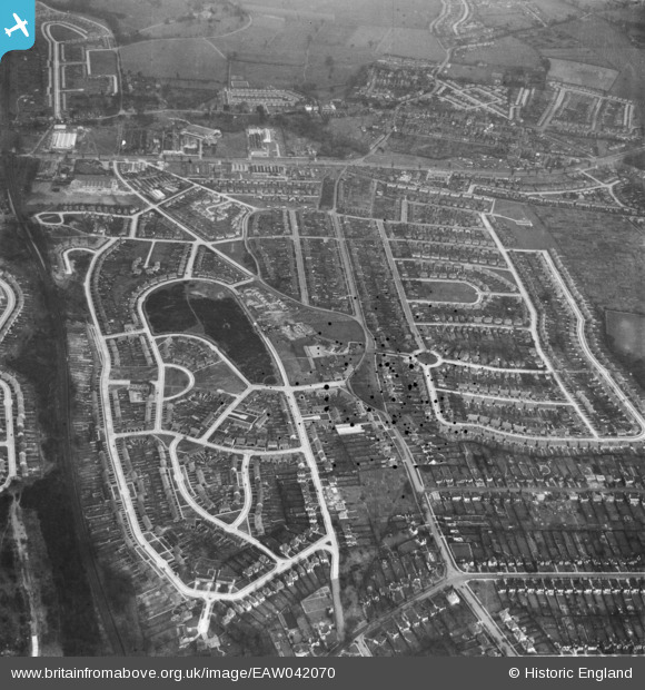
EAW042070 ENGLAND (1952). Housing estates at Poverest, Orpington, 1952. This image has been produced from a damaged negative.
© Copyright OpenStreetMap contributors and licensed by the OpenStreetMap Foundation. 2024. Cartography is licensed as CC BY-SA.
Nearby Images (5)
EAW042070

EAW042071

EAW042067

EAW042069

EAW026808

Details
| Title | [EAW042070] Housing estates at Poverest, Orpington, 1952. This image has been produced from a damaged negative. |
| Reference | EAW042070 |
| Date | March-1952 |
| Link | |
| Place name | ORPINGTON |
| Parish | |
| District | |
| Country | ENGLAND |
| Easting / Northing | 546134, 167846 |
| Longitude / Latitude | 0.10055848959053, 51.390315988093 |
| National Grid Reference | TQ461678 |
Pins
 Mike Floate |
Wednesday 31st of December 2014 02:41:15 PM | |
Mike Floate |
Wednesday 31st of December 2014 02:40:23 PM | |
 |
Gone2Kent |
Monday 6th of October 2014 08:34:31 PM |
Gone2Kent |
Monday 6th of October 2014 08:19:44 PM |


