
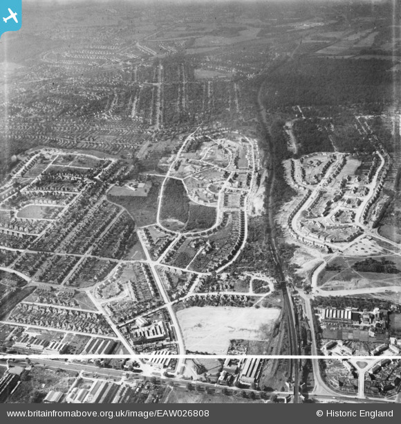
EAW026808 ENGLAND (1949). Housing estate under construction at Poverest, Bromley, 1949. This image was marked by Aerofilms Ltd for photo editing.
© Copyright OpenStreetMap contributors and licensed by the OpenStreetMap Foundation. 2024. Cartography is licensed as CC BY-SA.
Nearby Images (7)
EAW026808

EAW020718

EAW020731

EAW020732

EAW042071

EAW042070

EAW042067

Details
| Title | [EAW026808] Housing estate under construction at Poverest, Bromley, 1949. This image was marked by Aerofilms Ltd for photo editing. |
| Reference | EAW026808 |
| Date | 3-October-1949 |
| Link | |
| Place name | BROMLEY |
| Parish | |
| District | |
| Country | ENGLAND |
| Easting / Northing | 546186, 168070 |
| Longitude / Latitude | 0.10139766196527, 51.392315595395 |
| National Grid Reference | TQ462681 |
Pins
 FlyingWombat |
Monday 14th of April 2014 10:24:53 PM | |
FlyingWombat |
Monday 14th of April 2014 10:24:14 PM | |
FlyingWombat |
Monday 14th of April 2014 10:21:59 PM | |
FlyingWombat |
Monday 14th of April 2014 10:15:36 PM |


