
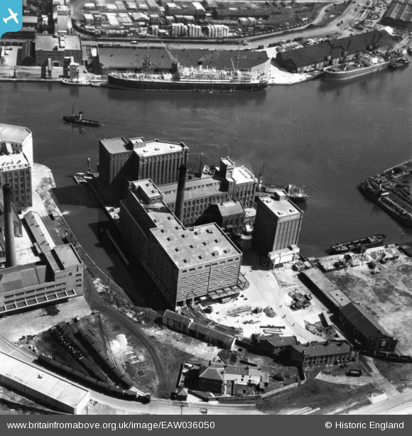
EAW036050 ENGLAND (1951). Joseph Rank Ltd Ocean Flour Mills, Birkenhead, 1951. This image has been produced from a print.
© Copyright OpenStreetMap contributors and licensed by the OpenStreetMap Foundation. 2024. Cartography is licensed as CC BY-SA.
Nearby Images (22)
EAW036050

EAW038507

EAW038501

EAW036054

EAW036053

EAW036051

EAW036048

EAW038508

EAW036052

EAW038504

EAW038503

EAW038502

EAW038505

EAW038500

EAW036049

EAW001724

EAW038506

EPW041994

EPW041997

EPW041995

EPW041996

EAW001790

Details
| Title | [EAW036050] Joseph Rank Ltd Ocean Flour Mills, Birkenhead, 1951. This image has been produced from a print. |
| Reference | EAW036050 |
| Date | 11-May-1951 |
| Link | |
| Place name | BIRKENHEAD |
| Parish | |
| District | |
| Country | ENGLAND |
| Easting / Northing | 330425, 390214 |
| Longitude / Latitude | -3.04663486786, 53.403893748729 |
| National Grid Reference | SJ304902 |
Pins
Be the first to add a comment to this image!


