
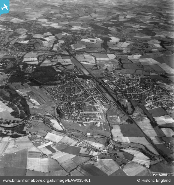
EAW035461 ENGLAND (1951). The town and surrounding countryside, Welwyn Garden City, 1951. This image has been produced from a print.
© Copyright OpenStreetMap contributors and licensed by the OpenStreetMap Foundation. 2024. Cartography is licensed as CC BY-SA.
Nearby Images (26)
EAW035461

EPW022017

EPW062075

EPW054513

EPW047365

EPW047342

EPW047357

EPW047362

EPW054540

EAW013993

EAW013995

EPW047361

EPW047379

EPW047364

EPW054496

EPW022030

EPW054538

EPW062076

EPW054494

EPW054493

EPW025528

EPW047377

EPW047356

EPW047363

EPW054497

EPW054533

Details
| Title | [EAW035461] The town and surrounding countryside, Welwyn Garden City, 1951. This image has been produced from a print. |
| Reference | EAW035461 |
| Date | 17-April-1951 |
| Link | |
| Place name | WELWYN GARDEN CITY |
| Parish | |
| District | |
| Country | ENGLAND |
| Easting / Northing | 523586, 212856 |
| Longitude / Latitude | -0.20750760031496, 51.800225627902 |
| National Grid Reference | TL236129 |
Pins
Be the first to add a comment to this image!


