
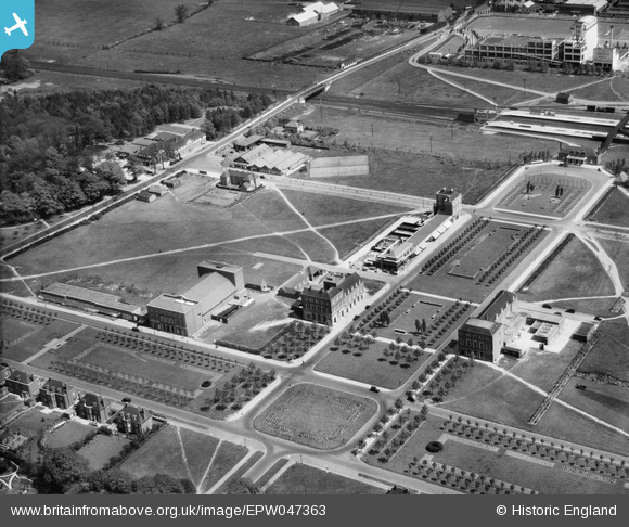
EPW047363 ENGLAND (1935). Howardsgate, Welwyn Garden City, 1935
© Copyright OpenStreetMap contributors and licensed by the OpenStreetMap Foundation. 2024. Cartography is licensed as CC BY-SA.
Nearby Images (27)
EPW047363

EPW054493

EPW047364

EPW054497

EPW054496

EPW054533

EPW047362

EPW047365

EPW047361

EPW054498

EPW025528

EPW022015

EPW022023

EAW013995

EPW062006

EPW062002

EPW022024

EPW062005

EPW062001

EPW062003

EPW022026

EPW054513

EPW025536

EPW054505

EPW054502

EAW035461

EPW062050

Details
| Title | [EPW047363] Howardsgate, Welwyn Garden City, 1935 |
| Reference | EPW047363 |
| Date | May-1935 |
| Link | |
| Place name | WELWYN GARDEN CITY |
| Parish | |
| District | |
| Country | ENGLAND |
| Easting / Northing | 523756, 213038 |
| Longitude / Latitude | -0.20497824519626, 51.801823773971 |
| National Grid Reference | TL238130 |
Pins
 John Wass |
Sunday 13th of March 2016 08:32:29 PM | |
The 'Fast lines' run through this station clear of any platforms. At this time the two pairs of platforms served the Slow up and down lines, and also the two branches, one to Luton and Dunstable and the other to Hertford. |
John W |
Wednesday 22nd of March 2017 11:04:40 PM |


