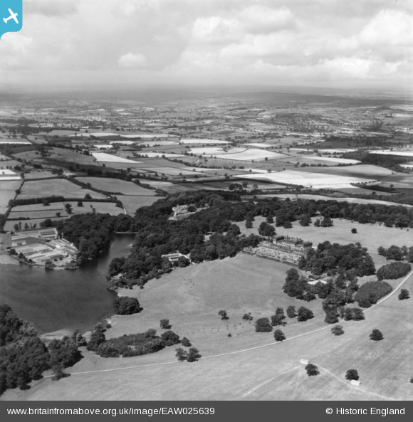
EAW025639 ENGLAND (1949). Harewood House and surrounding countryside, Harewood, from the south-east, 1949. This image has been produced from a print.
© Copyright OpenStreetMap contributors and licensed by the OpenStreetMap Foundation. 2024. Cartography is licensed as CC BY-SA.
Details
| Title | [EAW025639] Harewood House and surrounding countryside, Harewood, from the south-east, 1949. This image has been produced from a print. |
| Reference | EAW025639 |
| Date | 3-August-1949 |
| Link | |
| Place name | HAREWOOD |
| Parish | HAREWOOD |
| District | |
| Country | ENGLAND |
| Easting / Northing | 431298, 444324 |
| Longitude / Latitude | -1.5236912158499, 53.893943024886 |
| National Grid Reference | SE313443 |
Pins
 John W |
Thursday 28th of July 2016 08:08:49 PM | |
 Brick Collector |
Friday 25th of December 2015 03:28:21 PM | |
 Brick Collector |
Friday 25th of December 2015 03:25:32 PM |


![[EAW025639] Harewood House and surrounding countryside, Harewood, from the south-east, 1949. This image has been produced from a print.](http://britainfromabove.org.uk/sites/all/libraries/aerofilms-images/public/100x100/EAW/025/EAW025639.jpg)
![[EAW025640] Harewood House and grounds, Harewood, from the south, 1949](http://britainfromabove.org.uk/sites/all/libraries/aerofilms-images/public/100x100/EAW/025/EAW025640.jpg)