
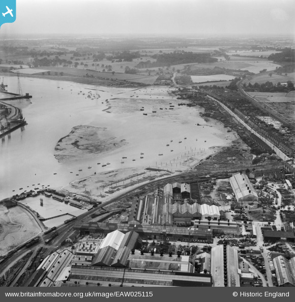
EAW025115 ENGLAND (1949). The Eagle Steelworks, River Orwell and Wherstead Road, Ipswich, from the north-east, 1949
© Copyright OpenStreetMap contributors and licensed by the OpenStreetMap Foundation. 2024. Cartography is licensed as CC BY-SA.
Nearby Images (24)
EAW025115

EAW025112

EAW026269

EAW026272

EAW025111

EAW026270

EAW026267

EPW041401

EAW025109

EAW026265

EAW024669

EAW025114

EAW025113

EAW025110

EAW026266

EAW026273

EAW025108

EAW026271

EAW024670

EPW032851

EAW026268

EPW024986

EPW024976

EPW001826

Details
| Title | [EAW025115] The Eagle Steelworks, River Orwell and Wherstead Road, Ipswich, from the north-east, 1949 |
| Reference | EAW025115 |
| Date | 22-July-1949 |
| Link | |
| Place name | IPSWICH |
| Parish | |
| District | |
| Country | ENGLAND |
| Easting / Northing | 616589, 243131 |
| Longitude / Latitude | 1.1587225527624, 52.043769004551 |
| National Grid Reference | TM166431 |
Pins
 Bunny |
Saturday 4th of July 2020 05:50:34 PM |


