
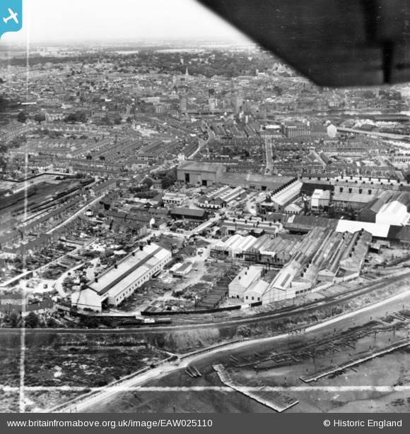
EAW025110 ENGLAND (1949). The Eagle Steelworks and environs, Ipswich, from the south, 1949. This image has been produced from a print marked by Aerofilms Ltd for photo editing.
© Copyright OpenStreetMap contributors and licensed by the OpenStreetMap Foundation. 2024. Cartography is licensed as CC BY-SA.
Nearby Images (22)
EAW025110

EAW026271

EAW026266

EAW025114

EAW026265

EAW025113

EAW026273

EAW026267

EAW026272

EAW026270

EAW025111

EAW026269

EAW026268

EAW025115

EAW025112

EAW024670

EAW025109

EAW025108

EAW024669

EPW041401

EPW032851

EPW001826

Details
| Title | [EAW025110] The Eagle Steelworks and environs, Ipswich, from the south, 1949. This image has been produced from a print marked by Aerofilms Ltd for photo editing. |
| Reference | EAW025110 |
| Date | 22-July-1949 |
| Link | |
| Place name | IPSWICH |
| Parish | |
| District | |
| Country | ENGLAND |
| Easting / Northing | 616487, 243043 |
| Longitude / Latitude | 1.1571817082021, 52.043018777568 |
| National Grid Reference | TM165430 |
Pins
Be the first to add a comment to this image!


