
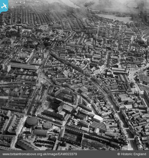
EAW023379 ENGLAND (1949). The city centre, Preston, 1949
© Copyright OpenStreetMap contributors and licensed by the OpenStreetMap Foundation. 2024. Cartography is licensed as CC BY-SA.
Nearby Images (9)
EAW023379

EAW023378

EPW055130

EAW023377

EPW055144

EPW055134

EPW055131

EPW004018

EPW004019

Details
| Title | [EAW023379] The city centre, Preston, 1949 |
| Reference | EAW023379 |
| Date | 25-May-1949 |
| Link | |
| Place name | PRESTON |
| Parish | |
| District | |
| Country | ENGLAND |
| Easting / Northing | 353836, 429547 |
| Longitude / Latitude | -2.7003126379623, 53.760012355796 |
| National Grid Reference | SD538295 |
Pins
 Russky |
Friday 27th of May 2016 11:41:51 AM | |
Duck |
Monday 13th of April 2015 06:14:06 PM | |
Duck |
Monday 13th of April 2015 06:13:06 PM | |
Duck |
Monday 13th of April 2015 06:12:14 PM | |
Duck |
Monday 13th of April 2015 06:09:14 PM | |
Duck |
Monday 13th of April 2015 06:08:24 PM | |
Duck |
Monday 13th of April 2015 06:07:51 PM | |
Duck |
Monday 13th of April 2015 06:06:06 PM | |
Duck |
Monday 13th of April 2015 06:04:53 PM | |
Duck |
Monday 13th of April 2015 06:04:13 PM | |
Duck |
Monday 13th of April 2015 06:03:46 PM | |
Duck |
Monday 13th of April 2015 05:59:27 PM | |
Duck |
Monday 13th of April 2015 05:59:07 PM | |
Duck |
Monday 13th of April 2015 05:58:07 PM | |
Duck |
Monday 13th of April 2015 05:57:42 PM | |
Duck |
Monday 13th of April 2015 05:56:59 PM | |
Duck |
Monday 13th of April 2015 05:56:38 PM |