
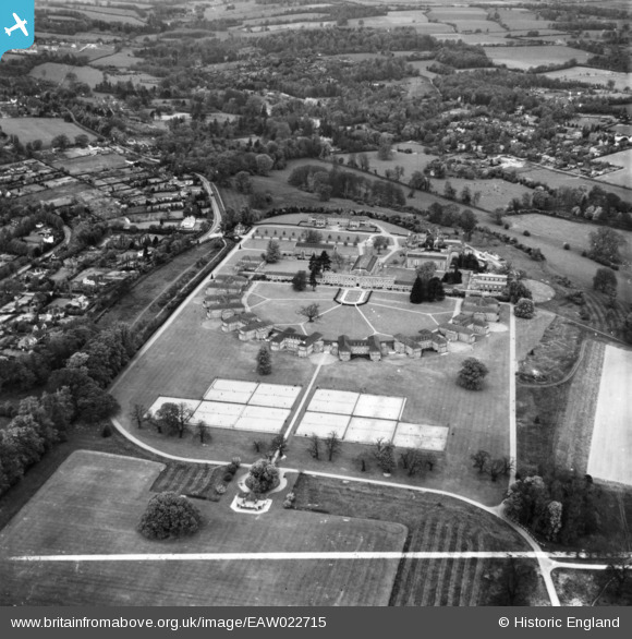
EAW022715 ENGLAND (1949). The Royal Masonic School for Girls, Rickmansworth, 1949. This image has been produced from a print marked by Aerofilms Ltd for photo editing.
© Copyright OpenStreetMap contributors and licensed by the OpenStreetMap Foundation. 2024. Cartography is licensed as CC BY-SA.
Nearby Images (19)
EAW022715

EPW044252

EAW022713

EPW044251

EPW044253

EPW017776

EAW022710

EAW022714

EAW022717

EPW044249

EPW044245

EPW044248

EPW044247

EPW044250

EPW044246

EPW017772

EAW022712

EAW022716

EPW017771

Details
| Title | [EAW022715] The Royal Masonic School for Girls, Rickmansworth, 1949. This image has been produced from a print marked by Aerofilms Ltd for photo editing. |
| Reference | EAW022715 |
| Date | 2-May-1949 |
| Link | |
| Place name | RICKMANSWORTH |
| Parish | |
| District | |
| Country | ENGLAND |
| Easting / Northing | 505707, 195370 |
| Longitude / Latitude | -0.47202540110635, 51.646711238565 |
| National Grid Reference | TQ057954 |
Pins
Be the first to add a comment to this image!


