
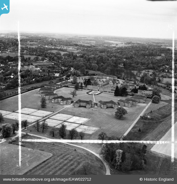
EAW022712 ENGLAND (1949). The Royal Masonic School for Girls and environs, Rickmansworth, from the south-east, 1949. This image has been produced from a print marked by Aerofilms Ltd for photo editing.
© Copyright OpenStreetMap contributors and licensed by the OpenStreetMap Foundation. 2024. Cartography is licensed as CC BY-SA.
Nearby Images (20)
EAW022712

EPW044248

EPW044247

EPW044250

EPW017773

EAW022717

EPW017775

EPW044246

EPW044249

EPW044245

EPW017768

EPW017772

EPW017776

EAW022710

EPW044251

EPW017770

EPW044252

EAW022715

EAW022713

EPW044253

Details
| Title | [EAW022712] The Royal Masonic School for Girls and environs, Rickmansworth, from the south-east, 1949. This image has been produced from a print marked by Aerofilms Ltd for photo editing. |
| Reference | EAW022712 |
| Date | 2-May-1949 |
| Link | |
| Place name | RICKMANSWORTH |
| Parish | |
| District | |
| Country | ENGLAND |
| Easting / Northing | 505899, 195202 |
| Longitude / Latitude | -0.46930201187617, 51.645164939182 |
| National Grid Reference | TQ059952 |
Pins
 Matt Aldred edob.mattaldred.com |
Thursday 7th of March 2024 02:53:06 PM |


