
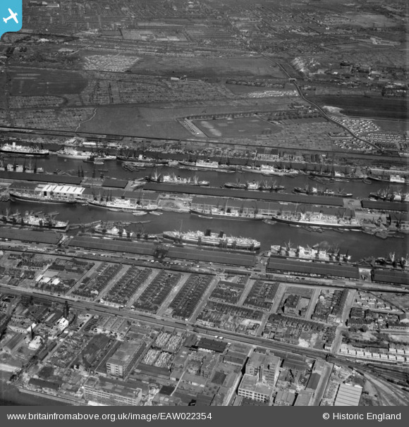
EAW022354 ENGLAND (1949). The Royal Albert and King George V Docks, North Woolwich, 1949
© Copyright OpenStreetMap contributors and licensed by the OpenStreetMap Foundation. 2024. Cartography is licensed as CC BY-SA.
Nearby Images (14)
EAW022354

EPW044119

EAW022359

EAW000035

EAW021702

EPW010729

EPW008890

EAW021704

EPW056681

EPW044116

EAW000052

EAW021713

EAW000037

EPW032930

Details
| Title | [EAW022354] The Royal Albert and King George V Docks, North Woolwich, 1949 |
| Reference | EAW022354 |
| Date | 19-April-1949 |
| Link | |
| Place name | NORTH WOOLWICH |
| Parish | |
| District | |
| Country | ENGLAND |
| Easting / Northing | 542884, 180428 |
| Longitude / Latitude | 0.058956325168857, 51.504215573817 |
| National Grid Reference | TQ429804 |
Pins
 redmist |
Tuesday 30th of June 2020 09:43:45 AM |


