
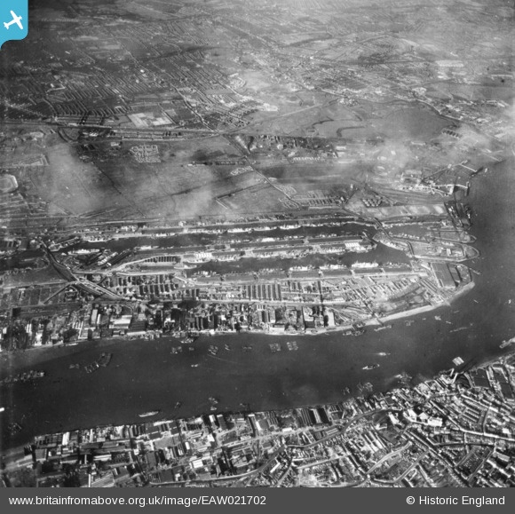
EAW021702 ENGLAND (1949). The Royal Albert Dock and the King George V Dock, North Woolwich, 1949. This image has been produced from a print.
© Copyright OpenStreetMap contributors and licensed by the OpenStreetMap Foundation. 2024. Cartography is licensed as CC BY-SA.
Nearby Images (15)
EAW021702

EPW044119

EAW022354

EPW044116

EAW000035

EAW021704

EPW008890

EPW032930

EAW000037

EAW022359

EAW021713

EPW010729

EPW005310

EAW000052

EPW056681

Details
| Title | [EAW021702] The Royal Albert Dock and the King George V Dock, North Woolwich, 1949. This image has been produced from a print. |
| Reference | EAW021702 |
| Date | 26-March-1949 |
| Link | |
| Place name | NORTH WOOLWICH |
| Parish | |
| District | |
| Country | ENGLAND |
| Easting / Northing | 542853, 180538 |
| Longitude / Latitude | 0.058554486747994, 51.50521194763 |
| National Grid Reference | TQ429805 |
Pins
 redmist |
Saturday 4th of July 2020 10:55:01 PM | |
redmist |
Saturday 4th of July 2020 10:54:25 PM | |
John W |
Monday 2nd of May 2016 07:33:09 PM | |
John W |
Monday 2nd of May 2016 07:31:46 PM | |
John W |
Monday 2nd of May 2016 07:30:49 PM |


