
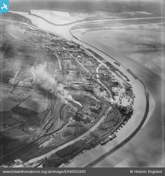
EAW021993 ENGLAND (1949). Weston Point, Runcorn, 1949
© Copyright OpenStreetMap contributors and licensed by the OpenStreetMap Foundation. 2024. Cartography is licensed as CC BY-SA.
Nearby Images (3)
EAW021993

EAW023477

EAW023478

Details
| Title | [EAW021993] Weston Point, Runcorn, 1949 |
| Reference | EAW021993 |
| Date | 9-April-1949 |
| Link | |
| Place name | RUNCORN |
| Parish | |
| District | |
| Country | ENGLAND |
| Easting / Northing | 349752, 381571 |
| Longitude / Latitude | -2.75455279237, 53.328397028268 |
| National Grid Reference | SJ498816 |
Pins
Be the first to add a comment to this image!


