
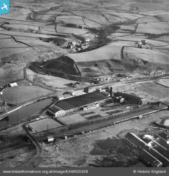
EAW020428 ENGLAND (1948). Green Vale Cotton Mill, Calderbrook, 1948
© Copyright OpenStreetMap contributors and licensed by the OpenStreetMap Foundation. 2024. Cartography is licensed as CC BY-SA.
Nearby Images (10)
EAW020428

EAW020424

EAW020420

EAW020427
 4-6-0 5226 passing the Green Vale Cotton Mill, Calderbrook, 1948")
EAW020423

EAW020421

EAW020426

EAW020425

EAW020434

EAW020419

Details
| Title | [EAW020428] Green Vale Cotton Mill, Calderbrook, 1948 |
| Reference | EAW020428 |
| Date | 8-November-1948 |
| Link | |
| Place name | CALDERBROOK |
| Parish | |
| District | |
| Country | ENGLAND |
| Easting / Northing | 394718, 417599 |
| Longitude / Latitude | -2.079927928799, 53.654628829721 |
| National Grid Reference | SD947176 |
Pins
 Moonraker |
Wednesday 18th of October 2023 03:45:54 PM |