
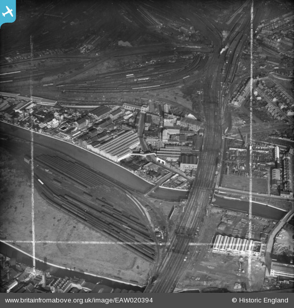
EAW020394 ENGLAND (1948). Industrial premises between Carpenter's Road and Waterworks River and environs, Stratford Marsh, 1948. This image was marked by Aerofilms Ltd for photo editing.
© Copyright OpenStreetMap contributors and licensed by the OpenStreetMap Foundation. 2024. Cartography is licensed as CC BY-SA.
Nearby Images (16)
EAW020394

EPW026722

EAW020397

EPW026720

EAW020390

EAW020396

EPW026721

EAW020391

EAW020398

EPW026723

EPW026719

EAW020395

EAW020393

EAW020401

EAW020400

EAW020399

Details
| Title | [EAW020394] Industrial premises between Carpenter's Road and Waterworks River and environs, Stratford Marsh, 1948. This image was marked by Aerofilms Ltd for photo editing. |
| Reference | EAW020394 |
| Date | 4-November-1948 |
| Link | |
| Place name | STRATFORD MARSH |
| Parish | |
| District | |
| Country | ENGLAND |
| Easting / Northing | 538150, 184077 |
| Longitude / Latitude | -0.0077845269049888, 51.538186514581 |
| National Grid Reference | TQ382841 |
Pins
Be the first to add a comment to this image!


