
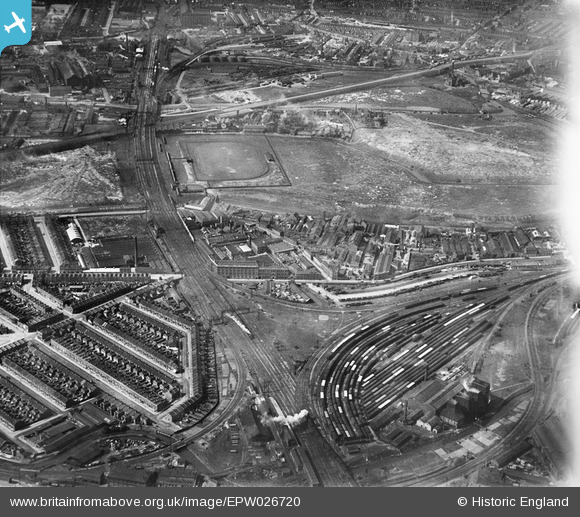
EPW026720 ENGLAND (1929). Jenson and Nicholson Varnish and Enamel Works and environs, Stratford, 1929
© Copyright OpenStreetMap contributors and licensed by the OpenStreetMap Foundation. 2024. Cartography is licensed as CC BY-SA.
Nearby Images (16)
EPW026720

EAW020396

EAW020390

EPW026721

EAW020397

EAW020394

EPW026723

EAW020391

EPW026719

EPW026722

EAW020393

EAW020395

EAW020398

EAW020401

EAW020400

EAW020399

Details
| Title | [EPW026720] Jenson and Nicholson Varnish and Enamel Works and environs, Stratford, 1929 |
| Reference | EPW026720 |
| Date | May-1929 |
| Link | |
| Place name | STRATFORD |
| Parish | |
| District | |
| Country | ENGLAND |
| Easting / Northing | 538164, 184116 |
| Longitude / Latitude | -0.0075674587209059, 51.538533580704 |
| National Grid Reference | TQ382841 |


