
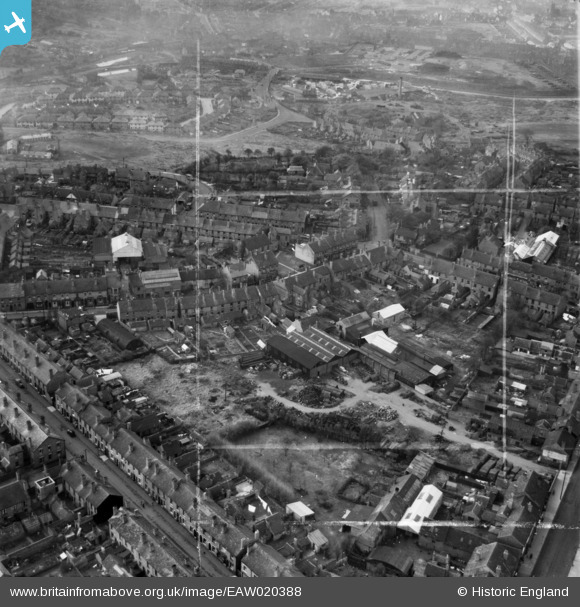
EAW020388 ENGLAND (1948). The Hayes Works (Spades, Shovels & Forks) and environs, Blackheath, 1948. This image was marked by Aerofilms Ltd for photo editing.
© Copyright OpenStreetMap contributors and licensed by the OpenStreetMap Foundation. 2024. Cartography is licensed as CC BY-SA.
Nearby Images (10)
EAW020388
 and environs, Blackheath, 1948. This image was marked by Aerofilms Ltd for photo editing.")
EAW020385
, Holly Road, Beeches Road and environs, Blackheath, 1948. This image was marked by Aerofilms Ltd for photo editing.")
EAW020386
, Beeches Road and environs, Blackheath, 1948. This image was marked by Aerofilms Ltd for photo editing.")
EAW020383
, Holly Road, Beeches Road and environs, Blackheath, 1948. This image was marked by Aerofilms Ltd for photo editing.")
EAW020384
, High Street and environs, Blackheath, 1948. This image was marked by Aerofilms Ltd for photo editing.")
EAW020382
, High Street and environs, Blackheath, 1948. This image was marked by Aerofilms Ltd for photo editing.")
EAW020387
, High Street and environs, Blackheath, 1948. This image was marked by Aerofilms Ltd for photo editing.")
EPW061083

EAW020389
, High Street and environs, Blackheath, from the north, 1948. This image was marked by Aerofilms Ltd for photo editing.")
EPW061084

Details
| Title | [EAW020388] The Hayes Works (Spades, Shovels & Forks) and environs, Blackheath, 1948. This image was marked by Aerofilms Ltd for photo editing. |
| Reference | EAW020388 |
| Date | 4-November-1948 |
| Link | |
| Place name | BLACKHEATH |
| Parish | |
| District | |
| Country | ENGLAND |
| Easting / Northing | 396936, 286312 |
| Longitude / Latitude | -2.0451145424157, 52.474360938321 |
| National Grid Reference | SO969863 |
