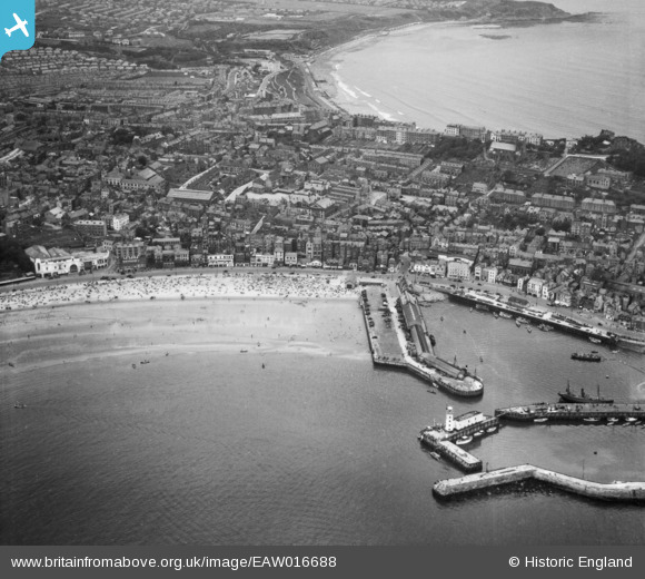
EAW016688 ENGLAND (1948). The Old Harbour, the town and North Bay, Scarborough, from the south-east, 1948
© Copyright OpenStreetMap contributors and licensed by the OpenStreetMap Foundation. 2024. Cartography is licensed as CC BY-SA.
Nearby Images (9)
EAW016688

EAW016690

EAW016694

EPW029089

EAW016689

EAW016692

EAW007948

EAW007941

EPW018341

Details
| Title | [EAW016688] The Old Harbour, the town and North Bay, Scarborough, from the south-east, 1948 |
| Reference | EAW016688 |
| Date | 23-June-1948 |
| Link | |
| Place name | SCARBOROUGH |
| Parish | |
| District | |
| Country | ENGLAND |
| Easting / Northing | 504802, 488607 |
| Longitude / Latitude | -0.39004985378474, 54.282182351115 |
| National Grid Reference | TA048886 |
Pins
 Brigham |
Wednesday 26th of September 2018 02:41:55 PM | |
 Alan McFaden |
Thursday 9th of January 2014 11:50:04 AM | |
Alan McFaden |
Thursday 9th of January 2014 11:49:37 AM | |
Alan McFaden |
Thursday 9th of January 2014 11:48:57 AM | |
Alan McFaden |
Thursday 9th of January 2014 11:48:36 AM |