
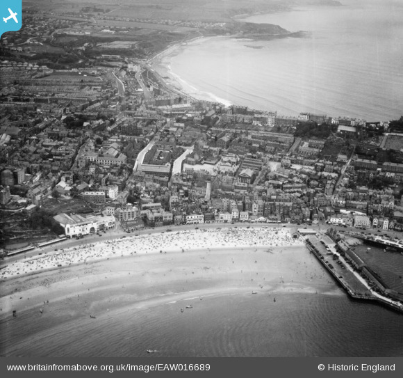
EAW016689 ENGLAND (1948). Foreshore Road, the town and North Bay, Scarborough, from the south-east, 1948
© Copyright OpenStreetMap contributors and licensed by the OpenStreetMap Foundation. 2024. Cartography is licensed as CC BY-SA.
Nearby Images (8)
EAW016689

EAW016692

EAW016690

EAW016688

EAW016694

EAW007941

EPW029092

EAW007948

Details
| Title | [EAW016689] Foreshore Road, the town and North Bay, Scarborough, from the south-east, 1948 |
| Reference | EAW016689 |
| Date | 23-June-1948 |
| Link | |
| Place name | SCARBOROUGH |
| Parish | |
| District | |
| Country | ENGLAND |
| Easting / Northing | 504658, 488645 |
| Longitude / Latitude | -0.39224769546555, 54.282553275239 |
| National Grid Reference | TA047886 |
Pins
 Mullenaround |
Saturday 2nd of January 2016 09:56:05 PM | |
 Alan McFaden |
Monday 20th of January 2014 06:14:20 PM | |
Alan McFaden |
Monday 20th of January 2014 06:13:54 PM | |
Alan McFaden |
Monday 20th of January 2014 06:13:18 PM | |
Alan McFaden |
Monday 20th of January 2014 06:12:50 PM |


