
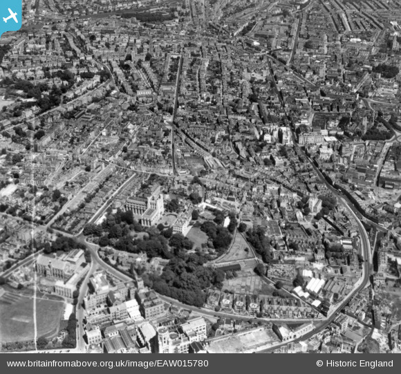
EAW015780 ENGLAND (1948). Tyndall's Park and Kingsdown, Bristol, 1948. This image has been produced from a print marked by Aerofilms Ltd for photo editing.
© Copyright OpenStreetMap contributors and licensed by the OpenStreetMap Foundation. 2024. Cartography is licensed as CC BY-SA.
Nearby Images (8)
EAW015780

EAW015785

EAW015784

EPW047092

EPW041484

EAW015779

EAW015783

EAW015782

Details
| Title | [EAW015780] Tyndall's Park and Kingsdown, Bristol, 1948. This image has been produced from a print marked by Aerofilms Ltd for photo editing. |
| Reference | EAW015780 |
| Date | 18-May-1948 |
| Link | |
| Place name | BRISTOL |
| Parish | |
| District | |
| Country | ENGLAND |
| Easting / Northing | 358426, 173487 |
| Longitude / Latitude | -2.5984535425758, 51.458343529096 |
| National Grid Reference | ST584735 |
Pins
 Glenner |
Thursday 2nd of December 2021 08:13:36 AM | |
Chrisd |
Monday 19th of October 2020 02:34:01 PM | |
Chrisd |
Monday 19th of October 2020 02:30:44 PM | |
hilary |
Tuesday 29th of December 2015 02:15:35 PM | |
hilary |
Tuesday 29th of December 2015 02:14:29 PM | |
hilary |
Tuesday 29th of December 2015 02:13:38 PM | |
hilary |
Tuesday 29th of December 2015 02:12:33 PM | |
hilary |
Tuesday 29th of December 2015 02:11:15 PM |


