
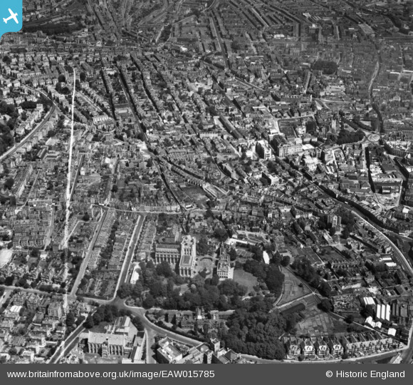
EAW015785 ENGLAND (1948). Tyndall's Park and Kingsdown, Bristol, 1948. This image has been produced from a print marked by Aerofilms Ltd for photo editing.
© Copyright OpenStreetMap contributors and licensed by the OpenStreetMap Foundation. 2024. Cartography is licensed as CC BY-SA.
Nearby Images (4)
EAW015785

EAW015780

EPW005477

EAW015784

Details
| Title | [EAW015785] Tyndall's Park and Kingsdown, Bristol, 1948. This image has been produced from a print marked by Aerofilms Ltd for photo editing. |
| Reference | EAW015785 |
| Date | 18-May-1948 |
| Link | |
| Place name | BRISTOL |
| Parish | |
| District | |
| Country | ENGLAND |
| Easting / Northing | 358518, 173556 |
| Longitude / Latitude | -2.5971373857086, 51.458970733981 |
| National Grid Reference | ST585736 |
Pins
Be the first to add a comment to this image!


