
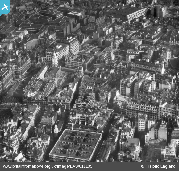
EAW011135 ENGLAND (1947). Wormwood Street, St Botolph's Church and environs, London, 1947. This image has been produced from a print.
© Copyright OpenStreetMap contributors and licensed by the OpenStreetMap Foundation. 2024. Cartography is licensed as CC BY-SA.
Nearby Images (8)
EAW011135

EAW011194

EAW011134

EPW024269

EAW011195
, Bury Street and environs, London, 1947")
EAW026317

EAW011136

EAW011378

Details
| Title | [EAW011135] Wormwood Street, St Botolph's Church and environs, London, 1947. This image has been produced from a print. |
| Reference | EAW011135 |
| Date | 30-September-1947 |
| Link | |
| Place name | LONDON |
| Parish | |
| District | |
| Country | ENGLAND |
| Easting / Northing | 533148, 181434 |
| Longitude / Latitude | -0.080871587137134, 51.515635045861 |
| National Grid Reference | TQ331814 |
Pins
 Alan McFaden |
Thursday 16th of October 2014 09:36:27 AM |
