
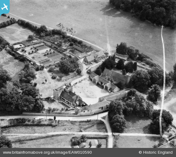
EAW010590 ENGLAND (1947). St Mary's Church, the Manor House and the village, Buriton, 1947. This image was marked by Aerofilms Ltd for photo editing.
© Copyright OpenStreetMap contributors and licensed by the OpenStreetMap Foundation. 2024. Cartography is licensed as CC BY-SA.
Nearby Images (8)
EAW010590

EAW010589

EAW010586

EAW010585

EAW010587

EAW010588

EAW010584

EAW010583

Details
| Title | [EAW010590] St Mary's Church, the Manor House and the village, Buriton, 1947. This image was marked by Aerofilms Ltd for photo editing. |
| Reference | EAW010590 |
| Date | 3-September-1947 |
| Link | |
| Place name | BURITON |
| Parish | BURITON |
| District | |
| Country | ENGLAND |
| Easting / Northing | 474051, 120022 |
| Longitude / Latitude | -0.94515456408085, 50.974300514098 |
| National Grid Reference | SU741200 |
Pins
 totoro |
Friday 7th of August 2015 07:26:11 PM | |
totoro |
Friday 7th of August 2015 07:25:03 PM |


